
Via Ferrata topographic map
Interactive map
Click on the map to display elevation.
About this map
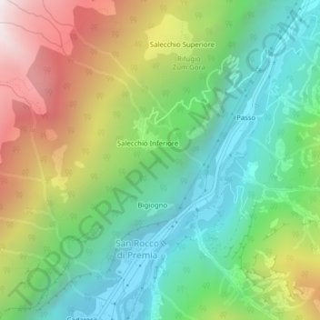
Name: Via Ferrata topographic map, elevation, terrain.
Location: Via Ferrata, Premia, VB, Piemonte, 28866, Italia (46.30135 8.36049 46.32135 8.38049)
Average elevation: 1,306 m
Minimum elevation: 746 m
Maximum elevation: 2,266 m