
Krimpenerwaard topographic map
Interactive map
Click on the map to display elevation.
About this map
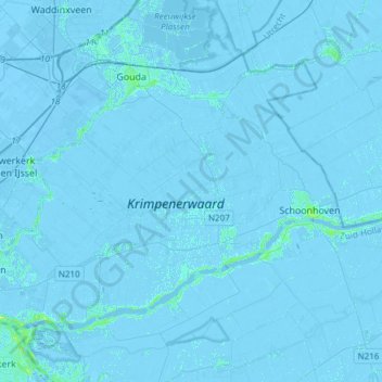
Name: Krimpenerwaard topographic map, elevation, terrain.
Location: Krimpenerwaard, South Holland, Netherlands (51.88935 4.57633 52.02227 4.87779)
Average elevation: -1 m
Minimum elevation: -8 m
Maximum elevation: 11 m
Dutch topographic map of the municipality of Krimpenerwaard, June 2015