
Castellàs topographic map
Interactive map
Click on the map to display elevation.
About this map
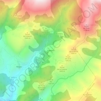
Name: Castellàs topographic map, elevation, terrain.
Location: Castellàs, Alta Ribagorça, Lleida, Catalonia, Spain (42.39454 0.78981 42.43454 0.82981)
Average elevation: 1,329 m
Minimum elevation: 927 m
Maximum elevation: 1,823 m