
Ploče topographic map
Interactive map
Click on the map to display elevation.
About this map
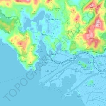
Name: Ploče topographic map, elevation, terrain.
Location: Ploče, Grad Ploče, Dubrovnik-Neretva County, 20340, Croatia (43.01337 17.39604 43.09337 17.47604)
Average elevation: 67 m
Minimum elevation: -5 m
Maximum elevation: 409 m