
Lockenhaus topographic map
Interactive map
Click on the map to display elevation.
About this map
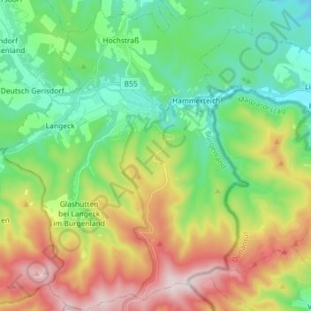
Name: Lockenhaus topographic map, elevation, terrain.
Location: Lockenhaus, Bezirk Oberpullendorf, Burgenland, 7442, Austria (47.34432 16.34892 47.44104 16.46350)
Average elevation: 492 m
Minimum elevation: 283 m
Maximum elevation: 874 m
Other topographic maps
Click on a map to view its topography, its elevation and its terrain.