
Corrie Fee topographic map
Interactive map
Click on the map to display elevation.
About this map
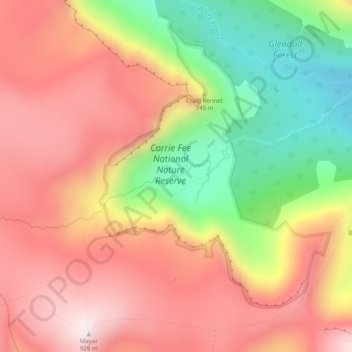
Name: Corrie Fee topographic map, elevation, terrain.
Location: Corrie Fee, Angus, Scotland, United Kingdom (56.86108 -3.23405 56.86118 -3.23395)
Average elevation: 671 m
Minimum elevation: 340 m
Maximum elevation: 924 m
Angus trails, hiking, mountain biking, running and outdoor activities
Other topographic maps
Click on a map to view its topography, its elevation and its terrain.