
Churchtown-Orwell ED topographic map
Interactive map
Click on the map to display elevation.
About this map
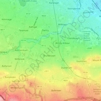
Name: Churchtown-Orwell ED topographic map, elevation, terrain.
Average elevation: 54 m
Minimum elevation: -1 m
Maximum elevation: 135 m
Other topographic maps
Click on a map to view its topography, its elevation and its terrain.
Rathfarnham
Rathfarnham, Churchtown-Castle ED, Dublin 14, Dún Laoghaire-Rathdown, County Dublin, Leinster, DUBLIN 14, Ireland
Average elevation: 56 m