
Isle of Man topographic map
Interactive map
Click on the map to display elevation.
About this map
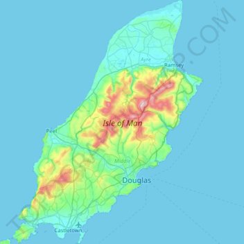
Name: Isle of Man topographic map, elevation, terrain.
Location: Isle of Man, Braddan, Middle, Isle of Man (54.05396 -4.79468 54.41787 -4.30769)
Average elevation: 48 m
Minimum elevation: 0 m
Maximum elevation: 616 m