
Lungi topographic map
Interactive map
Click on the map to display elevation.
About this map
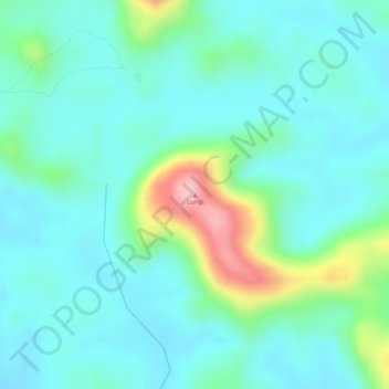
Name: Lungi topographic map, elevation, terrain.
Average elevation: 142 m
Minimum elevation: 97 m
Maximum elevation: 283 m
Other topographic maps
Click on a map to view its topography, its elevation and its terrain.
Poye
Poye, Bo District, Southern Province, Sierra Leone, Sierra Leone
Average elevation: 127 m
Palima
Sierra Leone > Bo District > Palima
Palima, Bo District, Southern Province, Sierra Leone, Sierra Leone
Average elevation: 98 m
Sulima
Sierra Leone > Bo District > Sulima
Sulima, Bo District, Southern Province, Sierra Leone, Sierra Leone
Average elevation: 120 m
Gerihun
Sierra Leone > Bo District > Gerihun
Gerihun, Bo District, Southern Province, Sierra Leone
Average elevation: 102 m