Geolocate

Hangal topographic map

Interactive map

Click on the map to display elevation.

About this map

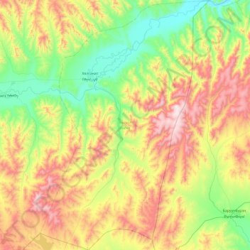
Name: Hangal topographic map, elevation, terrain.

Location: Hangal, Bulgan, Mongolia (49.08074 104.10309 49.68610 104.73352)

Average elevation: 1,167 m

Minimum elevation: 721 m

Maximum elevation: 1,978 m

Other topographic maps

Click on a map to view its topography, its elevation and its terrain.

Unit

Mongolia > Bulgan > Khutag-Undur

Unit, Khutag-Undur, Bulgan, Mongolia

Average elevation: 1,236 m

Khangal

Mongolia > Bulgan > Hangal

Khangal, Hangal, Bulgan, Mongolia

Average elevation: 1,076 m

Bulgan

Mongolia > Bulgan > Bulgan

Bulgan, Mongolia

Average elevation: 1,369 m

Selenge

Mongolia > Bulgan > Selenge

Selenge, Bulgan, Mongolia

Average elevation: 1,262 m