
Red Bluff topographic map
Interactive map
Click on the map to display elevation.
About this map
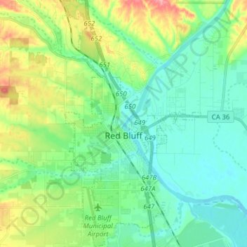
Name: Red Bluff topographic map, elevation, terrain.
Average elevation: 103 m
Minimum elevation: 74 m
Maximum elevation: 176 m
Other topographic maps
Click on a map to view its topography, its elevation and its terrain.
Beegum Peak
United States > California > Tehama County
Beegum Peak, Tehama County, California, 96076, United States
Average elevation: 920 m
Corning
United States > California > Tehama County
Corning, Tehama County, CAL Fire Northern Region, California, 96021, United States
Average elevation: 86 m