
Gotska Sandön topographic map
Interactive map
Click on the map to display elevation.
About this map
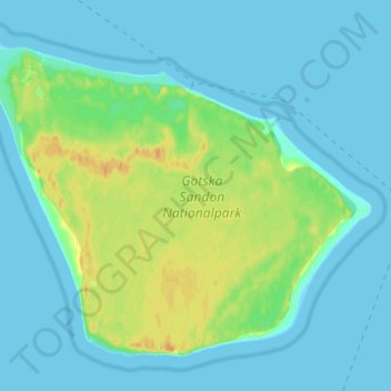
Name: Gotska Sandön topographic map, elevation, terrain.
Average elevation: 7 m
Minimum elevation: 0 m
Maximum elevation: 29 m
Other topographic maps
Click on a map to view its topography, its elevation and its terrain.
Burge
Sweden > Gotland County > Burge
Burge, Gotlands kommun, Gotland County, Region Götaland, Sweden
Average elevation: 24 m
Lummelunda
Sweden > Gotland County > Lummelunda
Lummelunda, Gotland, Gotland County, Territorial waters of Gotland, Sweden
Average elevation: 42 m