
Pennance Point topographic map
Interactive map
Click on the map to display elevation.
About this map
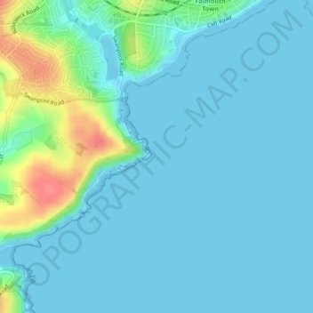
Name: Pennance Point topographic map, elevation, terrain.
Location: Pennance Point, Falmouth, England, TR11 5BG, United Kingdom (50.12418 -5.08216 50.14418 -5.06216)
Average elevation: 12 m
Minimum elevation: -1 m
Maximum elevation: 68 m
Other topographic maps
Click on a map to view its topography, its elevation and its terrain.
Falmouth
United Kingdom > England > Falmouth
Falmouth, Cornwall, South West England, England, TR11 3AT, United Kingdom
Average elevation: 33 m
Pendennis Castle
United Kingdom > England > Falmouth
Pendennis Castle, Castle Drive, Falmouth, Cornwall, South West England, England, TR11 4WZ, United Kingdom
Average elevation: 2 m
The Beacon
United Kingdom > England > Falmouth
The Beacon, Falmouth, Cornwall, South West England, England, United Kingdom
Average elevation: 28 m