
Okavango Delta topographic map
Interactive map
Click on the map to display elevation.
Okavango Delta
The Okavango Delta (or Okavango Grassland; formerly spelled "Okovango" or "Okovanggo") in Botswana is a vast inland delta formed where the Okavango River reaches a tectonic trough at an altitude of 930–1,000 m in the central part of the endorheic basin of the Kalahari Desert.
About this map
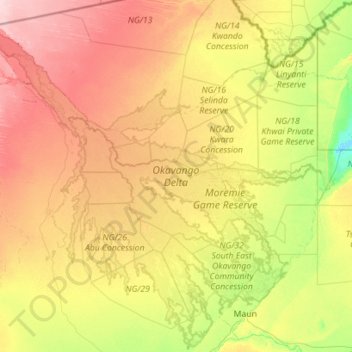
Name: Okavango Delta topographic map, elevation, terrain.
Location: Okavango Delta, North-West District, Botswana (-20.19750 21.66445 -18.11046 23.90722)
Average elevation: 959 m
Minimum elevation: 918 m
Maximum elevation: 1,039 m
Other topographic maps
Click on a map to view its topography, its elevation and its terrain.