
Ludmannsdorf topographic map
Interactive map
Click on the map to display elevation.
About this map
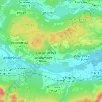
Name: Ludmannsdorf topographic map, elevation, terrain.
Location: Ludmannsdorf, Klagenfurt-Land, Carinthia, 9072, Austria (46.52987 14.08438 46.56798 14.21915)
Average elevation: 631 m
Minimum elevation: 425 m
Maximum elevation: 1,331 m