
Davie topographic map
Interactive map
Click on the map to display elevation.
About this map
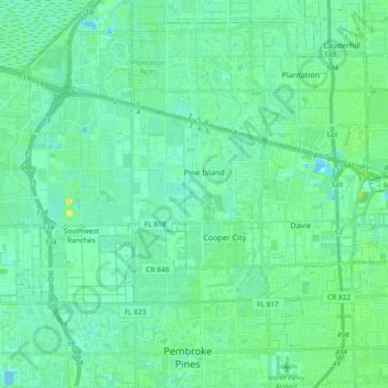
Name: Davie topographic map, elevation, terrain.
Location: Davie, Broward County, Florida, United States (26.02950 -80.36948 26.12289 -80.18383)
Average elevation: 6 m
Minimum elevation: -2 m
Maximum elevation: 20 m
Other topographic maps
Click on a map to view its topography, its elevation and its terrain.
Bonita Bay
United States > Florida > Broward County > Fort Lauderdale > Soroka Shores
Average elevation: 4 m
Bonita Bay
United States > Florida > Broward County > Fort Lauderdale > Soroka Shores
Average elevation: 4 m
Fort Lauderdale Beach
United States > Florida > Broward County > Fort Lauderdale > Birch Ocean Front
Average elevation: 3 m