
Edelstal topographic map
Interactive map
Click on the map to display elevation.
About this map
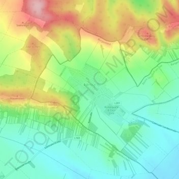
Name: Edelstal topographic map, elevation, terrain.
Location: Edelstal, Bezirk Neusiedl am See, Burgenland, 2413, Austria (48.08412 16.96866 48.11204 17.02874)
Average elevation: 213 m
Minimum elevation: 143 m
Maximum elevation: 330 m
Other topographic maps
Click on a map to view its topography, its elevation and its terrain.
Nickelsdorf
Austria > Burgenland > Bezirk Neusiedl am See
Nickelsdorf, Bezirk Neusiedl am See, Burgenland, 2425, Austria
Average elevation: 139 m
Gemeinde Neusiedl am See
Austria > Burgenland > Bezirk Neusiedl am See
Gemeinde Neusiedl am See, Bezirk Neusiedl am See, Burgenland, 7100, Austria
Average elevation: 138 m
Kittsee
Austria > Burgenland > Bezirk Neusiedl am See > Gemeinde Kittsee
Kittsee, Gemeinde Kittsee, Bezirk Neusiedl am See, Burgenland, 2421, Austria
Average elevation: 139 m