
Saundersfoot topographic map
Interactive map
Click on the map to display elevation.
About this map
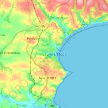
Name: Saundersfoot topographic map, elevation, terrain.
Location: Saundersfoot, Pembrokeshire, Wales, SA69 9EN, United Kingdom (51.67089 -4.73980 51.75089 -4.65980)
Average elevation: 41 m
Minimum elevation: 0 m
Maximum elevation: 138 m