
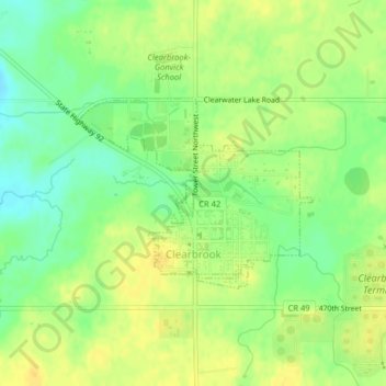
Clearbrook topographic map
Interactive map
Click on the map to display elevation.
About this map
Name: Clearbrook topographic map, elevation, terrain.
Average elevation: 410 m
Minimum elevation: 395 m
Maximum elevation: 421 m
Other topographic maps
Click on a map to view its topography, its elevation and its terrain.
Lake Itasca
United States > Minnesota > Clearwater County
Lake Itasca, Clearwater County, Minnesota, United States
Average elevation: 463 m
Bagley
United States > Minnesota > Clearwater County
Bagley, Clearwater County, Minnesota, 56621, United States
Average elevation: 445 m
Leonard
United States > Minnesota > Clearwater County > Leonard
Leonard, Clearwater County, Minnesota, United States
Average elevation: 440 m
Lake Itasca
United States > Minnesota > Clearwater County > Lake Itasca
Lake Itasca, Clearwater County, Minnesota, 56480, United States
Average elevation: 460 m