
Bembridge Harbour topographic map
Interactive map
Click on the map to display elevation.
About this map
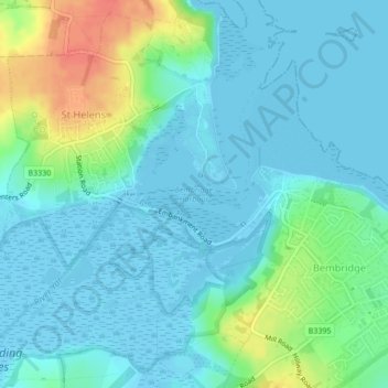
Name: Bembridge Harbour topographic map, elevation, terrain.
Average elevation: 12 m
Minimum elevation: -8 m
Maximum elevation: 50 m
Other topographic maps
Click on a map to view its topography, its elevation and its terrain.
Hillway
United Kingdom > England > Isle of Wight > Bembridge
Hillway, Bembridge, Isle of Wight, England, PO35 5PN, United Kingdom
Average elevation: 18 m