
Benguela topographic map
Interactive map
Click on the map to display elevation.
About this map
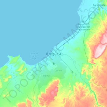
Name: Benguela topographic map, elevation, terrain.
Location: Benguela, Benguela Province, Angola (-12.73900 13.24371 -12.41900 13.56371)
Average elevation: 88 m
Minimum elevation: 0 m
Maximum elevation: 498 m
Other topographic maps
Click on a map to view its topography, its elevation and its terrain.