
Tobermory topographic map
Interactive map
Click on the map to display elevation.
About this map
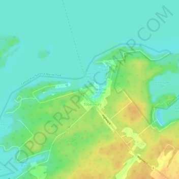
Name: Tobermory topographic map, elevation, terrain.
Location: Tobermory, Bruce County, Ontario, N0H 2R0, Canada (45.23665 -81.68600 45.27665 -81.64600)
Average elevation: 182 m
Minimum elevation: 170 m
Maximum elevation: 201 m