
Gössendorf topographic map
Interactive map
Click on the map to display elevation.
About this map
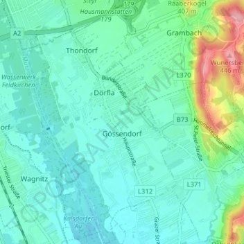
Name: Gössendorf topographic map, elevation, terrain.
Location: Gössendorf, Graz-Umgebung, Styria, 8077, Austria (46.97719 15.46081 47.02067 15.50153)
Average elevation: 340 m
Minimum elevation: 314 m
Maximum elevation: 441 m