
Chirades topographic map
Interactive map
Click on the map to display elevation.
About this map
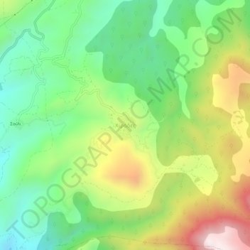
Name: Chirades topographic map, elevation, terrain.
Average elevation: 708 m
Minimum elevation: 380 m
Maximum elevation: 1,229 m
Other topographic maps
Click on a map to view its topography, its elevation and its terrain.
Megalopoli
Greece > Peloponnese, Western Greece and the Ionian > Arcadia Regional Unit > Municipal Unit of Megalopoli
Megalopoli, Municipal Unit of Megalopoli, Municipality of Megalopoli, Arcadia Regional Unit, Peloponnese Region, Peloponnese, Western Greece and the Ionian, 222 00, Greece
Average elevation: 434 m