
Lleida topographic map
Interactive map
Click on the map to display elevation.
About this map
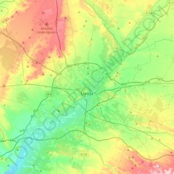
Name: Lleida topographic map, elevation, terrain.
Location: Lleida, Segrià, Lleida, Catalonia, Spain (41.51035 0.36360 41.73957 0.74198)
Average elevation: 222 m
Minimum elevation: 96 m
Maximum elevation: 456 m
Other topographic maps
Click on a map to view its topography, its elevation and its terrain.
Puigverd de Lleida
Spain > Catalonia > Segrià > Puigverd de Lleida > Puigverd de Lleida
Average elevation: 217 m