
Denny topographic map
Interactive map
Click on the map to display elevation.
About this map
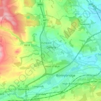
Name: Denny topographic map, elevation, terrain.
Location: Denny, Falkirk, Scotland, FK6 6EL, United Kingdom (55.98374 -3.94820 56.06374 -3.86820)
Average elevation: 86 m
Minimum elevation: 10 m
Maximum elevation: 253 m
Falkirk trails, hiking, mountain biking, running and outdoor activities
Other topographic maps
Click on a map to view its topography, its elevation and its terrain.
Union Canal
United Kingdom > Scotland > Falkirk
Canal commences from the sixteenth lock of the Forth and Clyde Navigation, about two miles west of Falkirk, in the county of Sterling , whence it takes an eastwardly course on the south side of the above-mentioned town, by some collieries; thence, through Black Hill Tunnel, and across the Glen Water, on which…
Average elevation: 136 m