
Leebotwood topographic map
Interactive map
Click on the map to display elevation.
About this map
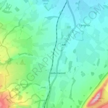
Name: Leebotwood topographic map, elevation, terrain.
Location: Leebotwood, Shropshire, West Midlands, England, United Kingdom (52.56775 -2.79349 52.61239 -2.74700)
Average elevation: 162 m
Minimum elevation: 103 m
Maximum elevation: 369 m