
Dolge njive topographic map
Interactive map
Click on the map to display elevation.
About this map
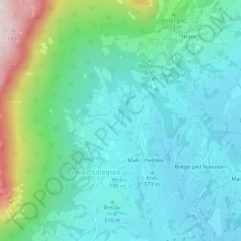
Name: Dolge njive topographic map, elevation, terrain.
Location: Dolge njive, Postojna, 6225, Slovenia (45.76736 14.06729 45.78736 14.08729)
Average elevation: 682 m
Minimum elevation: 536 m
Maximum elevation: 1,183 m
Other topographic maps
Click on a map to view its topography, its elevation and its terrain.