
Uludağ topographic map
Interactive map
Click on the map to display elevation.
About this map
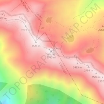
Name: Uludağ topographic map, elevation, terrain.
Location: Uludağ, Osmangazi, Bursa, Marmara Region, Turkey (40.07048 29.22196 40.07058 29.22206)
Average elevation: 2,265 m
Minimum elevation: 1,698 m
Maximum elevation: 2,535 m
Other topographic maps
Click on a map to view its topography, its elevation and its terrain.