
Tacuarembó topographic map
Interactive map
Click on the map to display elevation.
About this map
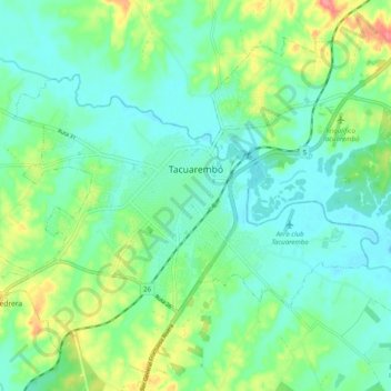
Name: Tacuarembó topographic map, elevation, terrain.
Location: Tacuarembó, 45000, Uruguay (-31.75113 -56.03208 -31.68228 -55.93233)
Average elevation: 143 m
Minimum elevation: 121 m
Maximum elevation: 200 m