
Tazmalt topographic map
Interactive map
Click on the map to display elevation.
About this map
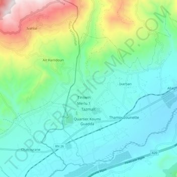
Name: Tazmalt topographic map, elevation, terrain.
Location: Tazmalt, Tazmalt District, Bejaia, 06006, Algeria (36.36342 4.37416 36.43235 4.47221)
Average elevation: 460 m
Minimum elevation: 212 m
Maximum elevation: 1,252 m