
Monte Priora topographic map
Interactive map
Click on the map to display elevation.
About this map
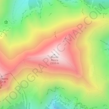
Name: Monte Priora topographic map, elevation, terrain.
Location: Monte Priora, Montefortino, Fermo, Marche, Italia (42.93213 13.24065 42.93223 13.24075)
Average elevation: 1,808 m
Minimum elevation: 1,287 m
Maximum elevation: 2,320 m