
Port Townsend topographic map
Interactive map
Click on the map to display elevation.
About this map
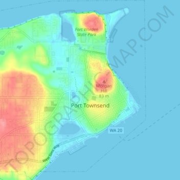
Name: Port Townsend topographic map, elevation, terrain.
Location: Port Townsend, Jefferson County, Washington, United States (48.09772 -122.81632 48.14630 -122.74714)
Average elevation: 19 m
Minimum elevation: -7 m
Maximum elevation: 90 m
Other topographic maps
Click on a map to view its topography, its elevation and its terrain.
Port Townsend
United States > Washington > Jefferson County > Port Townsend > Port Townsend
Average elevation: 18 m
Mount Olympus
United States > Washington > Jefferson County
With notable local relief, Mount Olympus ascends over 2,100 m (6,900 ft) from the 293 m (961 ft) elevation confluence of the Hoh River with Glacier Creek in only 8.8 km (5.5 mi). Mount Olympus has 2,386 m (7,828 ft) of prominence, ranking 5th in the state of Washington.
Average elevation: 1,934 m