
Charsadda topographic map
Interactive map
Click on the map to display elevation.
About this map
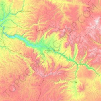
Name: Charsadda topographic map, elevation, terrain.
Location: Charsadda, Ghor Province, Afghanistan (34.94909 64.70218 35.26106 65.44902)
Average elevation: 2,542 m
Minimum elevation: 1,409 m
Maximum elevation: 3,654 m
Other topographic maps
Click on a map to view its topography, its elevation and its terrain.
Dahan Qoloni
Afghanistan > Ghor Province > La‘l wa Sar Jangal
Dahan Qoloni, La‘l wa Sar Jangal, Ghor Province, Afghanistan
Average elevation: 2,871 m