
Zirbitzkogel topographic map
Interactive map
Click on the map to display elevation.
About this map
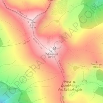
Name: Zirbitzkogel topographic map, elevation, terrain.
Location: Zirbitzkogel, Obdach, Murtal, Styria, 8742, Austria (47.06357 14.56717 47.06367 14.56727)
Average elevation: 2,069 m
Minimum elevation: 1,592 m
Maximum elevation: 2,383 m