
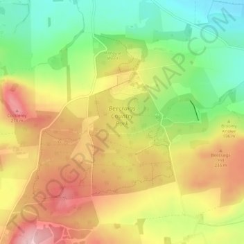
Beecraigs Country Park topographic map
Interactive map
Click on the map to display elevation.
About this map
Name: Beecraigs Country Park topographic map, elevation, terrain.
Average elevation: 186 m
Minimum elevation: 87 m
Maximum elevation: 284 m
Other topographic maps
Click on a map to view its topography, its elevation and its terrain.
Linlithgow Loch
United Kingdom > Scotland > Linlithgow
Linlithgow Loch, Parkhead Road, Linlithgow Bridge, Linlithgow, West Lothian, Scotland, United Kingdom
Average elevation: 77 m
Beecraigs Loch
United Kingdom > Scotland > Linlithgow
Beecraigs Loch, Sutherland Way, Wairdlaw, Linlithgow, West Lothian, Scotland, EH49 6PL, United Kingdom
Average elevation: 171 m