
Kiryat Gat topographic map
Interactive map
Click on the map to display elevation.
About this map
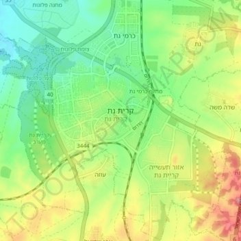
Name: Kiryat Gat topographic map, elevation, terrain.
Location: Kiryat Gat, South District, Israel (31.57510 34.74976 31.63847 34.80435)
Average elevation: 133 m
Minimum elevation: 87 m
Maximum elevation: 203 m
Other topographic maps
Click on a map to view its topography, its elevation and its terrain.
Kiryat Gat
Israel > South District > Kiryat Gat
Kiryat Gat, Ashkelon Subdistrict, South District, 8202280, Israel
Average elevation: 169 m