
Gomshall topographic map
Interactive map
Click on the map to display elevation.
About this map
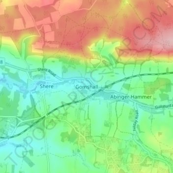
Name: Gomshall topographic map, elevation, terrain.
Location: Gomshall, Surrey, South East, England, GU5 9LJ, United Kingdom (51.19926 -0.46958 51.23926 -0.42958)
Average elevation: 133 m
Minimum elevation: 69 m
Maximum elevation: 233 m