
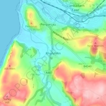
Rhydyfelin topographic map
Interactive map
Click on the map to display elevation.
About this map
Name: Rhydyfelin topographic map, elevation, terrain.
Location: Rhydyfelin, Ceredigion, Wales, SY23 4QB, United Kingdom (52.37040 -4.08896 52.41040 -4.04896)
Average elevation: 62 m
Minimum elevation: -1 m
Maximum elevation: 180 m