
Braunsbach topographic map
Interactive map
Click on the map to display elevation.
About this map
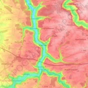
Name: Braunsbach topographic map, elevation, terrain.
Average elevation: 397 m
Minimum elevation: 228 m
Maximum elevation: 499 m
Other topographic maps
Click on a map to view its topography, its elevation and its terrain.
Satteldorf
Germany > Baden-Württemberg > Landkreis Schwäbisch Hall
Satteldorf, Verwaltungsverband Crailsheim, Landkreis Schwäbisch Hall, Baden-Württemberg, 74589, Germany
Average elevation: 446 m