Geolocate

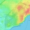
Kings Park topographic maps

Click on a map to view its topography, its elevation and its terrain.

Kings Park

Australia > Western Australia > Kings Park

Average elevation: 31 m

Gear up for your next adventure:

🧭Orienteering Compasses - Accurate compasses for map-based navigation
🥫Expedition Meals - Lightweight, high-calorie nutrition for long-distance hikers
🥾Walking Shoes - Lightweight walking shoes for countryside and coastal paths
🧺Mesh Stuff Sacks - Breathable storage for wet gear or camp organization
🧣Neck Gaiters - Protects against wind and sun on exposed ridges and peaks

As an Amazon Associate, this site earns from qualifying purchases at no extra cost to you.