Geolocate

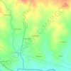
Jhalda - I topographic maps

Click on a map to view its topography, its elevation and its terrain.

Madhupur

India > West Bengal > Jhalda - I

Average elevation: 274 m

Gear up for your next adventure:

🎒Replacement Sternum Straps - Repair parts for hiking rucksacks
🛑Emergency Bivvy Bags - Heat-reflective survival bags for unexpected nights out
🥾Walking Shoes - Lightweight walking shoes for countryside and coastal paths
🔋Power Banks - Portable chargers for long outdoor trips
🧘Folding Sit Mats - Dry and warm seat for map-reading breaks on damp ground

As an Amazon Associate, this site earns from qualifying purchases at no extra cost to you.