Geolocate

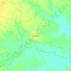
Rampurhat - II topographic maps

Click on a map to view its topography, its elevation and its terrain.

Margram

India > West Bengal > Rampurhat - II

Average elevation: 30 m

Gear up for your next adventure:

🥤Hiking Water Bottles - Reusable bottles for hydration on the trail
🗺️Topographic Maps - Detailed maps showing elevation and terrain features
🚲Bikepacking Frame Bags - Storage for tools and navigation gear on long off-road rides
⛺Camping Shelters - Emergency and lightweight shelters for outdoor use
🧭Professional Hiking Compasses - High-precision liquid-filled compasses for map reading and orientation

As an Amazon Associate, this site earns from qualifying purchases at no extra cost to you.