Geolocate

Greater London topographic maps

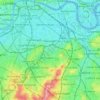
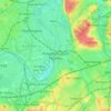
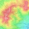
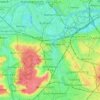
Click on a map to view its topography, its elevation and its terrain.

Coulsdon

United Kingdom > England > Greater London

1804. The Surrey Iron Railway was enhanced by the "Coulsdon Merstham & Godstone Railway". These were horsedrawn railways which carried quarried materials and crops from Coulsdon and Merstham, and returned with fuel, metals and other materials. To maintain a regular elevation at Coulsdon required large changes…

Average elevation: 125 m
Farthing Downs

United Kingdom > England > Greater London

Average elevation: 130 m

Catford

United Kingdom > England > Greater London

Average elevation: 38 m

Barnes

United Kingdom > England > Greater London

Average elevation: 17 m

Twickenham

United Kingdom > England > Greater London

Average elevation: 18 m

Lewisham

United Kingdom > England > Greater London

Average elevation: 28 m

Biggin Hill

United Kingdom > England > Greater London

Average elevation: 171 m

Chiswick

United Kingdom > England > Greater London

Average elevation: 18 m

Chelsfield

United Kingdom > England > Greater London

Average elevation: 117 m

Isleworth

United Kingdom > England > Greater London

If deemed to still include Osterley, elevations range from 27 m (89 ft) in the northwest to 4.9 m (16 ft) by the Thames OD. The boundaries are longstanding, subject to twentieth-century western and southern circonscriptions: Isleworth is east of the town of Hounslow which has more retail and offices, in the…

Average elevation: 19 m

Stave Hill

United Kingdom > England > Greater London

Average elevation: 6 m

Harefield

United Kingdom > England > Greater London

Average elevation: 66 m

Tooting

United Kingdom > England > Greater London

Average elevation: 30 m

Grove Park

United Kingdom > England > Greater London

Average elevation: 50 m

Foots Cray

United Kingdom > England > Greater London

Average elevation: 56 m

Kevingtown

United Kingdom > England > Greater London

Average elevation: 70 m

Kent

United Kingdom > England > Greater London

Average elevation: 28 m

Wood Green

United Kingdom > England > Greater London

Average elevation: 44 m

Gould's Green

United Kingdom > England > Greater London

Average elevation: 38 m

Chipping Barnet

United Kingdom > England > Greater London

Its name is very often abbreviated to just Barnet, which is also the name of the borough of which it forms a part; the town has been part of Greater London since 1965 after the abolition of Barnet Urban District then in Hertfordshire. Chipping Barnet is also the name of the Parliamentary constituency covering…

Average elevation: 95 m

Uxbridge Moor

United Kingdom > England > Greater London

Average elevation: 42 m

Downe

United Kingdom > England > Greater London

Average elevation: 143 m

Cedar Tree

United Kingdom > England > Greater London

Average elevation: 20 m

Primrose Hill

United Kingdom > England > Greater London

Average elevation: 46 m

Clissold Park

United Kingdom > England > Greater London

Average elevation: 32 m

Norwood Grove

United Kingdom > England > Greater London

After Anderson died, ownership passed to the Nettlefold family and subsequently to Frederick Nettlefold the brother of Joseph Nettlefold and a member of the family that founded the Nettlefolds Ltd. engineering firm which later became GKN. Nettlefold is commemorated, as a result of his charitable works, by a…

Average elevation: 58 m
Bostall Woods

United Kingdom > England > Greater London

Average elevation: 37 m

Warren Wood

United Kingdom > England > Greater London

Average elevation: 35 m

Waterlow Park

United Kingdom > England > Greater London

Average elevation: 77 m

Claybury Park

United Kingdom > England > Greater London

Average elevation: 36 m

Bedfords Park

United Kingdom > England > Greater London

Average elevation: 63 m

Trent Park

United Kingdom > England > Greater London

Average elevation: 78 m

The Warren

United Kingdom > England > Greater London

Average elevation: 37 m

Kingsmere

United Kingdom > England > Greater London

Average elevation: 38 m

River Wandle

United Kingdom > England > Greater London

Average elevation: 33 m

Pymmes Brook

United Kingdom > England > Greater London

Prior to the Anglian glaciation, a "proto-Mole-Wey" river was flowing northwards from the Weald and North Downs, through the "Finchley depression" and Palmers Green, to join the proto-Thames somewhere around Hoddesdon, at what is today an altitude of around 60 metres. It was this river which, during the course…

Average elevation: 41 m
Dollis Brook

United Kingdom > England > Greater London

Average elevation: 80 m

About this place

Gear up for your next adventure:

🎒Hiking Daypacks (20L) - Compact backpacks for day trips and technical mountain ascents
🛰️Outdoor GPS Navigation - Navigation devices for remote and off-grid areas
👖Convertible Hiking Trousers - Versatile zip-off pants for changing mountain weather conditions
🛰️Satellite Messengers - Emergency communication devices for areas without mobile signal
🔦LED Camping Lanterns - Illumination for reading maps inside your tent at night

As an Amazon Associate, this site earns from qualifying purchases at no extra cost to you.