Geolocate

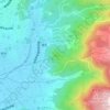
Kannami topographic maps

Click on a map to view its topography, its elevation and its terrain.

Mount Daisen

Japan > Tagata County > Kannami

Average elevation: 109 m

Gear up for your next adventure:

🧊Personal Water Filters - Drink safely from mountain streams marked on your map
🔭Compact Hiking Binoculars - Lightweight optics for scouting terrain and spotting wildlife
🧢Waterproof Hiking Hats - Keep the rain off your face while studying topographic maps
☕Insulated Travel Mugs - Keep drinks hot while surveying the landscape from a summit
🗺️Ordnance Survey Maps - Official UK maps for walking and outdoor activities

As an Amazon Associate, this site earns from qualifying purchases at no extra cost to you.