Geolocate

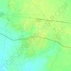
Goghat - I topographic maps

Click on a map to view its topography, its elevation and its terrain.

Goghat

India > West Bengal > Goghat - I

Average elevation: 22 m

Gear up for your next adventure:

👟Men's Trail Running Shoes - Lightweight grip for fast movement over topographic contours
🧥Packable Down Jackets - Lightweight warmth that compresses small in your bag
🍱Food Containers - Reusable containers for outdoor meals
⌚Altimeter Watches - Watches measuring altitude for mountain activities
📦Compression Sacks - Reduce backpack volume efficiently

As an Amazon Associate, this site earns from qualifying purchases at no extra cost to you.