Geolocate

Bath topographic maps

Click on a map to view its topography, its elevation and its terrain.
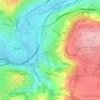
Bathwick Hill

United Kingdom > England > Bath and North East Somerset > Bath

Number 1 (Bathwick Lodge) is a 2-storey villa with a steep Mansard room, built in 1825, extended in 1840 and the late C19. Probably by John Pinch the Elder.[4] Number 2 is from the early 19th century and has shutters over the windows.[11] Number 3 includes a porch which is elaborately enriched with carving,…

Average elevation: 93 m

Gear up for your next adventure:

📢Survival Whistles - Essential safety gear for signaling for help in mountain fog
🧭Professional Hiking Compasses - High-precision liquid-filled compasses for map reading and orientation
👟Heavy Duty Boot Laces - Always carry a spare for your hiking footwear
🪓Outdoor Multitools - Versatile tools for hiking and camping
🦟Anti-Midge & Tick Repellent - Vital for hiking in the Scottish Highlands during summer

As an Amazon Associate, this site earns from qualifying purchases at no extra cost to you.