Geolocate

Tippecanoe County topographic maps

Click on a map to view its topography, its elevation and its terrain.
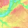
Lafayette

United States > Indiana > Tippecanoe County

Lafayette is located at 40°24′38″N 86°52′29″W / 40.410585°N 86.874681°W / 40.410585; -86.874681 (40.410585, −86.874681) and is located in Fairfield and Wea Townships. Elevation at the court house is 550 feet (168 m), but city elevations range from a little over 500 feet (150 m) at the…

Average elevation: 192 m

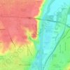
Shadeland

United States > Indiana > Tippecanoe County

Average elevation: 198 m

West Lafayette

United States > Indiana > Tippecanoe County

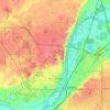
West Lafayette lies in central Tippecanoe County and overlooks the Wabash River, which borders the city on the east and south. Most of the city lies in eastern Wabash Township, though a small portion on the northeast side extends into Tippecanoe Township. Elevations range from slightly over 500 feet (150 m)…

Average elevation: 192 m

Stockwell

United States > Indiana > Tippecanoe County

Average elevation: 234 m

About this place

Gear up for your next adventure:

🧭Emergency Beacons - Safety beacons for remote outdoor locations
🥤Collapsible Water Bottles - Save space in your rucksack as you consume your water
🔪Outdoor Multi-Tools - Versatile tools for gear repairs and food prep in the wild
📱Rugged Phone Cases - Heavy-duty protection for smartphones used as secondary GPS tools
🥤Hiking Water Bottles - Reusable bottles for hydration on the trail

As an Amazon Associate, this site earns from qualifying purchases at no extra cost to you.