

Addington Highlands topographic maps
Click on a map to view its topography, its elevation and its terrain.

Vennachar
Canada > Ontario > Lennox and Addington County > Addington Highlands
Average elevation: 395 m
Weslemkoon Lake
Canada > Ontario > Lennox and Addington County > Addington Highlands
Average elevation: 324 m


Northbrook
Canada > Ontario > Lennox and Addington County > Addington Highlands
Average elevation: 260 m
Bon Echo Lake
Canada > Ontario > Lennox and Addington County > Addington Highlands
Average elevation: 313 m
Grimsthorpe Lake
Canada > Ontario > Lennox and Addington County > Addington Highlands
Average elevation: 336 m

Skootamatta Lake
Canada > Ontario > Lennox and Addington County > Addington Highlands
Average elevation: 301 m
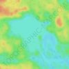
Joeperry Lake
Canada > Ontario > Lennox and Addington County > Addington Highlands
Joeperry Lake is the source of the Skootamatta River. It is about 2.2 kilometres (1.4 mi) long and 2.2 kilometres (1.4 mi) wide, and lies at an elevation of 315 metres (1,033 ft). There is one inflow, an unnamed creek at the west of the lake. The primary outflow is the Skootamatta River, on the south side of…
Average elevation: 328 m
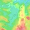
Denbigh Lake
Canada > Ontario > Lennox and Addington County > Addington Highlands > Denbigh
Average elevation: 372 m

Weslemkoon Lake
Canada > Ontario > Lennox and Addington County > Addington Highlands
Average elevation: 349 m
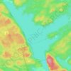
Upper Mazinaw Lake
Canada > Ontario > Lennox and Addington County > Addington Highlands
Average elevation: 296 m
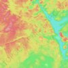
Bon Echo Provincial Park
Canada > Ontario > Lennox and Addington County > Addington Highlands
Average elevation: 321 m
