
Longopito topographic map
Interactive map
Click on the map to display elevation.
About this map
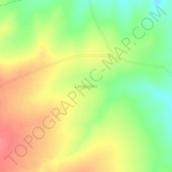
Name: Longopito topographic map, elevation, terrain.
Location: Longopito, Isiolo Central, Isiolo, Eastern, Kenya (0.68000 37.11330 0.72000 37.15330)
Average elevation: 1,151 m
Minimum elevation: 1,114 m
Maximum elevation: 1,183 m
Other topographic maps
Click on a map to view its topography, its elevation and its terrain.
Isiolo
Kenya > Isiolo > Isiolo Central
Isiolo, Isiolo Central, Isiolo, Eastern, Kenya
Average elevation: 1,096 m